
Brainerd & Cuyuna, MN
GRAVEL GUIDE
Jump to Section
Master Map
Brainerd Welcome Center Routes
Gull Lake Routes
Cuyuna Country Routes
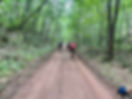
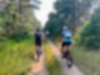
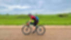
Located in central Minnesota, along the Mississippi River, is the Brainerd Lakes Area. Long known as the home of Paul Bunyan and well-known as Minnesota’s Vacationland, the neighboring cities of Baxter and Brainerd are the economic center of the region known as the Brainerd Lakes Area. This area sits on the ecological transition between the southern prairies and northern pines and contains some of the largest unfragmented forest in central Minnesota. The routes below meander through forests and farmlands. The area may be best known to cyclists for the longest Minnesota state trail, the Paul Bunyan Trail, stretching 115 miles from Crow Wing State Park to Bemidji State Park, or the 70+ miles of world class single-track mountain biking east of Brainerd in the Cuyuna Lakes State Recreation Area. But the area’s gravel cycling is quickly stealing the attention. Fueled by the Brainerd Family YMCA Gravel Grinders collection of events, group rides, and the Freedhem Gravel race, held the first weekend in July.
The routes below are a sample of gravel categorized in Brainerd Welcome Center Routes, Gull Lake Routes, and Cuyuna Country Routes. Each route center has distinct dining and lodging recommendations.
The local Gravel Grinders host group rides every Thursday at 6 p.m. from May- September. These no-drop rides are notorious for adding fun and adventure, from charcuterie board competitions and water crossings to pace-line Strava KOM chasers.
Created in collaboration with Josh Pennington & Mike Hawkins


MASTER GRAVEL GUIDE MAP

Join The Nxrth+ to View This Entire Guide as a Map
Where to Ride Gravel From Brainerd & Cuyuna
We've broken this map into 3 distinct gravel areas.
Brainerd Welcome Center Routes
The Brainerd Welcome Center is south of town at the entrance to Crow Wing State Park and the starting point for endless gravel route options. Here you will be greeted by a selfie worthy Paul Bunyan statue and miles of diverse gravel roads. Check out the Brainerd Gravel Grinders primary sponsor, Visit Brainerd, to learn more. Jump to Brainerd Welcome Center Routes.
Gull Lake Routes
Gull Lake is one of the largest lakes in the Brainerd Lakes area and also one of the most popular for vacationing and recreation. While the area is popular for lake resorts, dining and golf courses; the Pillsbury State Forest and surrounding rural gravel roads beckon gravel adventures. Jump to Gull Lake Routes.
Cuyuna Country Routes
Cuyuna is ranked among the best mountain biking destinations in the US, and the gravel cycling opportunities smoothly integrate with all the trails. There are more than 70 miles of single-track mountain biking trails throughout the historic iron ore mines. Today, these deep mine lakes offer incredible recreational opportunities and a community built around cycling. You’ll find many dining options, craft beer, and multiple styles of lodging to suit your tastes and budget—from camping to hostels, motels, lofts, B&Bs—even yurts. Jump to Cuyuna Country Routes.

Brainerd Welcome Center Routes
The Brainerd Welcome Center is south of town at the entrance to Crow Wing State Park and the starting point for endless gravel route options. Here you will be greeted by a selfie worthy Paul Bunyan statue and miles of diverse gravel roads. Check out the Brainerd Gravel Grinders primary sponsor, Visit Brainerd, to learn more .
The Bunyan | 15 Miles
This route will give you a little taste of every surface type in the area, including one of the most scenic stretches of the entire 115 mile paved Paul Bunyan State Trail. This flat loop on mixed surface is great for beginners or anyone looking for a short easy ride. An out and back spur at mile 12 leads to a perfect mid-ride stop along the Mississippi River for a charcuterie board snack or whatever else you may be packing. Link to Map.
County Line Loop | 27 Miles
Local gravel grinders know the biggest feature in this route as the Koering Hill. One of the areas most sought after Strava KOMs. It’s a short sprint up a notorious hill. You will traverse along the border of Crow Wing and Morrison counties on a road known for being a little soft. “Soft roads make hardened riders”. Link to Map.
Over the Hill | 34 Miles
This route is named after the infamous over the Hill Road, a local favorite. It’s a short minimum maintenance road. You’ll be happy when you’re “over the hill”. It begins by entering Crow Wing State Park, traveling along the Mississippi River. Although there are no good viewing options of the river along this stretch, you will benefit from the forested shade on a hot summer day. Crossing the Little Nokassippi River brings you to an historic landmark, well worth a quick pit stop to learn about the rich cultural history of this location while enjoying views of the Mississippi River. The next section of this route is the namesake. The road conditions vary, but will undoubtedly be remembered and talked about far after the ride is over. The second half of the route meanders through farmlands and forests with some of the areas biggest hills and fastest smooth gravel. Link to Map.
Freedhem | 100 Miles
While this route is not the official race route of the Freedhem gravel race, it does incorporate some of the best sections of the race route. The best stop along the way is the one-hundred-year-old Freedhem general store, the races namesake and starting and ending location, still stocked with any necessity you need or didn’t realize you need. The Freedhem Gravel race is a multi-distance gravel grinder organized by the Brainerd Family YMCA Gravel Grinders held on some of North Central Minnesota’s finest gravel, MMRs, and trails. Link to Map.
Gull Lake Routes
Gull Lake is one of the largest lakes in the Brainerd Lakes area and also one of the most popular for vacationing and recreation. While the area is popular for lake resorts, dining and golf courses; the Pillsbury State Forest and surrounding rural gravel roads beckon gravel adventures.
Sunshine-Summerhouse | 23 Miles
This short loop is a perfect evening spin ending at one of the areas best cocktail attractions. Dinner at the summerhouse is one of many dining options found along Gull lake. Link to Map.
Casino Loop | 27 Miles
You won’t find any gambling in this Casino. The only thing left in this small unincorporated community is the church, a few hills, and some amazing gravel roads. Link to Map.
Fritz Loven | 41 Miles
For those who love nature, including tall trees and a babbling brook and wildlife, Fritz Loven Park in Lake Shore is a must-see. This route begins and ends in the 80-acre park along scenic stony brook. It’s a mostly easy route, except for one section that has earned the title of the most difficult section within all the Brainerd Gravel Grinders route collections. Few have been able to ride the 1-mile minimum maintenance road without dismounting. Link to Map.
Pillsbury | 50 Miles
The roads through Pillsbury State Forest, Minnesota’s first State Forest, meander through a heavily forested area consisting of a variety of deciduous and coniferous trees. The woods are dotted with small lakes and ponds where you're likely to see evidence of beavers and other wildlife. This route begins along the scenic rolling hills of the gull lake paved trail before turning into the glacial carved landscape. Link to Map.
Buckskin 100 | 100 Miles
This mixed surface route connects the Pillsbury State Forest with the Foothills State Forest. Connecting with the Paul Bunyan Trail in Pine River offers opportunities to refuel and get water. The Pine River Bakery is an added bonus, just be sure to check their hours of operation. Glaciers began receding 12,000 years ago, leaving behind sediment and till that make up the landscapes rough, steep topography known as the St. Croix terminal moraine. There is no shortage of surface types along this route. Link to Map.

Cuyuna Country Routes
Cuyuna is ranked among the best mountain biking destinations in the US, and the gravel cycling opportunities smoothly integrate with all the trails. There are more than 70 miles of single-track mountain biking trails throughout the historic iron ore mines. Today, these deep mine lakes offer incredible recreational opportunities and a community built around cycling. You’ll find many dining options, craft beer, and multiple styles of lodging to suit your tastes and budget—from camping to hostels, motels, lofts, & even yurts.
Iron Hub Road | 16 Miles
This multi-surface ride has a little bit of everything, including a few miles of the infamous Cuyuna single-
track. The Cuyuna connector trail is smooth enough for a gravel bike, with rolling hills and hairpin turns.
The gravel road east of the town of Cuyuna is smoother than most paved roads. Link to Map.
Wolf Lake | 18 Miles
The majority of this route is quiet paved roads, but if you are looking to add adventure to this route,
swing through the Wolf Lake county forest roads and trails at mile 11. Trails through Wolf Lake are
rideable to some of the more arduous standards, but are more popular for the groomed Nordic ski trails
in the winter. Link to Map.
Black Bear | 20 Miles
Black bear is a popular motorized ATV/OHV riding area. The minimum maintenance roads leading into
black bear and around the former mining town of Trommald can be busy on weekends. On most
weekdays, you will most likely be the only person on these county forested roads. The route closes the
loop on a quiet paved road to the Cuyuna Lakes State trail, a paved non-motorized trail. Just a warning,
despite some of the route being paved, the minimum maintenance road sections will be much more
comfortable with large tires! Link to Map.
The Wood Tick | 100 Miles
This route begins at the Wood Tick Inn in the town of Cuyuna. Once organized an official gravel event, it
has since become a non-official gathering of local cyclists in September. Perhaps the event will return
one day under new organization. This route traverses through the hill and lake country of Crow Wing
and Aitkin Counties. There are no opportunities to refuel along the route, so be prepared. It is also easy
to shorten the route to 70 or 40 miles. If you happen to be in town the second Saturday in June, bring a
tick to join the annual wood tick races. You can also buy a tick for a dollar, but in this area, it’s certainly
not difficult to find one. Link to Map.